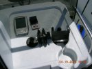
Photos of GPS
No. 1=Individual parts before assembly
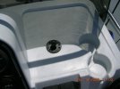
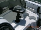
No. 2=Ball Mount: Only part that is screwed onto boat
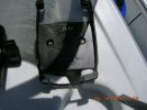
No. 3=Custom Holder for Dell Axim
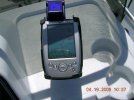
Nos. 4 & 5=Entire contraption mounted.
Notes: 1. Forgot to get photo of accessory plug to use 12VDC point.
2. I don't know if color lines will show up but if they do:
Blue=Route created on laptop and downloaded into Dell. You can create a route directly on the Dell but using the laptop's larger screen makes it easier and creates an archive of route
Red=Vector of where you will be in 10 minutes (programmable) and is best way I found to stay on route. Ideally red will be superimposed onto blue.
Yellow=Track of where you have been. Can be converted to route. When I first started going out I had a more experienced person take me where I wanted to go. I then transferred track to laptop, converted it to a route, transferred it back to PDA. Sounds complicated, is not.
Software is almost infinitely adjustable and will show you several things I didn't want to know (e.g. ETA). I think you can download a trial from their website
www.memory-map.com to try before you buy. Also the manual.
As for the complaint I had about the map always being North-South you can see that if you are going south while looking at such a map everything is reversed. Not normally a problem but if you have to make a sudden decision about a marker in the water you could (and I did) go on the wrong side of it. Kind of like stepping off a curb in London and looking the wrong way for the oncoming traffic.
Hope this is helpful. Any questions please don't hesitate to contact me.
MM
") I agree with you that it would be very handy to have on the boat if it were small enough and tough enough. And with satellite broadband Internet service you'd could have realtime weather displays with radar off the Internet!
I agree with you that it would be very handy to have on the boat if it were small enough and tough enough. And with satellite broadband Internet service you'd could have realtime weather displays with radar off the Internet!")